

Satellite technology is giving scientists, conservation organisations and carbon-market participants new ways to measure forest loss and estimate carbon stored in the Congo Basin, as concerns over unreliable carbon credits and the limited oversight of remote forests continue to affect the financing of conservation across Central Africa. The European Space Agency’s Biomass satellite, launched in April 2025, is using advanced radar to map forest structure, while newer monitoring systems are helping researchers identify deforestation risks and improve the verification of carbon credits linked to forest protection. The developments could strengthen the evidence underpinning conservation finance, although their impact will depend on whether governments and local institutions can act on the information and ensure that communities benefit from the resulting investments.
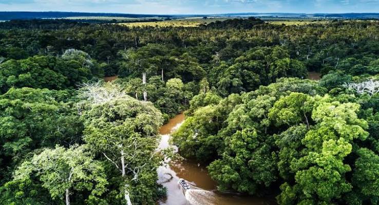
The Congo Basin rainforest spans Cameroon, the Central African Republic, the Republic of Congo, Equatorial Guinea, Gabon and the Democratic Republic of Congo (DRC). Its scale, dense vegetation and limited road access make consistent ground-based monitoring difficult, leaving gaps in the information available to authorities responsible for managing forests and enforcing environmental rules. Satellite observations can cover areas that field teams may struggle to reach, providing a wider view of forest conditions and changes in land use.

Biomass is designed to measure the structure of forests using P-band synthetic aperture radar, which sends long radio waves through the forest canopy to estimate the woody material in trunks and branches. These measurements provide an indication of above ground biomass, and, in turn, the carbon stored in forests. According to Reuters, the satellite passes over specific areas of the Congo rainforest approximately every three days, allowing scientists to build a more detailed picture of forest conditions over time.
The technology matters because the amount of carbon stored in a forest is central to the calculation of emissions avoided through conservation projects. Carbon credits generated by projects that claim to prevent deforestation depend on estimates of how much forest would have been lost without intervention. If that baseline is inaccurate, a project may receive credits for emissions reductions that did not occur, weakening the integrity of the market and reducing confidence among buyers financing forest protection.
These concerns have affected the market for credits associated with avoided deforestation, commonly linked to REDD+ projects. Reuters reported that a review by carbon market registry Verra found that the Kariba forest conservation project in Zimbabwe had issued more than twice as many credits as it should have, following an investigation into the deforestation assumptions used to calculate its impact. The case contributed to wider concerns about over-crediting and the reliability of claims made by forest conservation projects.
Satellite-based methodologies are increasingly being used to reduce the scope for project developers to determine their own deforestation baselines. Under newer approaches, registries can use satellite observations to estimate forest-loss rates across a country or province and compare these with changes inside individual project areas. This can make the calculation of avoided emissions more consistent and less dependent on assumptions selected by developers, although the quality of the results still depends on the methodology, data resolution and interpretation of observed changes.
The financial implications are significant for forest countries. Reuters cited carbon market intelligence firm Sylvera data showing that higher-rated avoided-deforestation credits were trading at about $7 per tonne, compared with an average of $26.10 per tonne for higher-rated credits generated through reforestation or afforestation. The difference illustrates how market confidence and credit type can affect the revenue available to conservation projects. Better verification could help improve the credibility of avoided deforestation credits, but satellite data alone cannot guarantee higher prices or greater investment. Demand, project quality, buyer policies and the rules governing credit issuance will continue to influence returns.
For the Congo Basin, these questions extend beyond carbon accounting. Forests support biodiversity, regulate water cycles and provide livelihoods through farming, forest products and other economic activities. They also hold substantial carbon stocks whose release can increase global emissions. Research published in Scientific Reports, cited by Reuters, found that African forests and woody savannahs had released more carbon than they absorbed since 2010, reflecting the effects of deforestation and forest degradation. The finding adds urgency to efforts to improve forest monitoring, but it also underlines the need for interventions that address the activities driving forest loss.
Agricultural expansion, logging and mining remain important pressures in parts of Central Africa. In the DRC, Reuters reported that primary forest loss has averaged roughly 0.5% annually over the past decade, with small-scale agriculture a major driver. Cameroon recorded its highest annual deforestation on record in 2025, partly associated with the expansion of cocoa plantations. Satellite alerts can help identify changes earlier, but they cannot resolve the economic pressures that lead households and businesses to clear land, nor can they replace effective land-use planning and enforcement.
Artificial intelligence is expanding the potential uses of satellite information by processing large datasets and identifying patterns associated with emerging threats. Monitoring platforms can alert companies when deforestation risks appear in areas linked to their commodity supply chains, giving them an opportunity to investigate sourcing practices or engage suppliers. For governments and conservation organisations, the same information could help direct limited field resources towards areas where forest loss is accelerating or where illegal logging and mining are suspected.
However, the ability to detect a threat is different from the ability to stop it. In remote areas where government authority and enforcement capacity are limited, accurate satellite information may reveal illegal activity without producing a timely response. Effective monitoring therefore requires coordination between data providers, environmental agencies, local authorities and conservation teams, as well as resources to investigate alerts and enforce the law. Without those links, more frequent observations may improve knowledge of forest loss without materially changing its trajectory.
The distribution of conservation revenue is another unresolved issue. Rainforest Foundation UK has raised concerns that income from carbon markets does not consistently reach communities that protect forests. The organisation is piloting a programme in 30 community forests in the DRC in which payments for forest protection are verified using satellite data. Such systems could make it easier to document changes in forest cover, but the credibility of the arrangement will also depend on transparent payment rules, clear community rights and accessible processes for resolving disputes.
Access to satellite information will matter for African institutions as well. Some monitoring platforms are operated by commercial providers, while others make data available to researchers and conservation groups. Governments, local organisations and community monitoring teams need the technical capacity to interpret the information and use it in decisions on land management, carbon projects and environmental enforcement. Investment in local expertise and data systems could help African institutions retain greater control over how forest information informs conservation policy and the commercial use of carbon assets.
The wider challenge is to connect improved measurement with credible governance. Satellite technology can make forest change more visible, strengthen the evidence used to issue carbon credits and help identify emerging threats. It cannot by itself establish land rights, ensure fair benefit sharing, enforce environmental law or guarantee that a conservation project delivers additional emissions reductions.

For Congo Basin countries seeking international climate finance, more reliable forest data could support stronger accountability and help distinguish credible projects from those built on weak assumptions. But the economic value of that information will ultimately depend on how it is used: whether it informs public decisions, improves the integrity of carbon markets and supports conservation arrangements that deliver verifiable results for both forests and the communities whose livelihoods depend on them.