

By Nita Bhalla
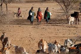
Kenya will launch its first localized weather modelling system early next year, providing key data on how climate change will impact crop production across the east African nation in the decades to come, the project’s founder said on Tuesday.
Developed by researchers at Kenya’s Jomo Kenyatta University of Agriculture and Technology, the Climate Atlas will provide projections on rainfall and temperature patterns across Kenya’s 47 counties from the year 2050 to 2100.
John Wesonga, the lead developer of the web-based Climate Atlas platform, said there were countless global climate modelling systems available, but none provided localized data for Kenya over a long period.
“The Climate Atlas will provide us with future scenarios of what the weather patterns will be like at a county-level in Kenya,” Wesonga told the Thomson Reuters Foundation.
“We are looking for data such as in which locations will we see the highest and lowest temperatures and rainfall, how high and low will the temperatures and rainfall likely to be, what time of year they will happen, and how long they will last.”
Based on those projections, policymakers, researchers, businesses and farmers will able to shift to interventions from using more resilient crop varieties to improving drainage during drought and floods respectively. Read more…